

An Introduction to "Chimney Field"
The following summary provides a brief description of the excavations SoTMAS have been carrying out at Hilderstone, in a field known locally as "Chimney Field." The field is part of the old Manor of Hilderstone and would have been occupied by a tenant of the Lord of the Manor. Which in the 17th century was a family called Gerard and in the 19th century the manor was owned by the Bournes. Between the two dates ownership changed several times and is too complex to be repeated here.
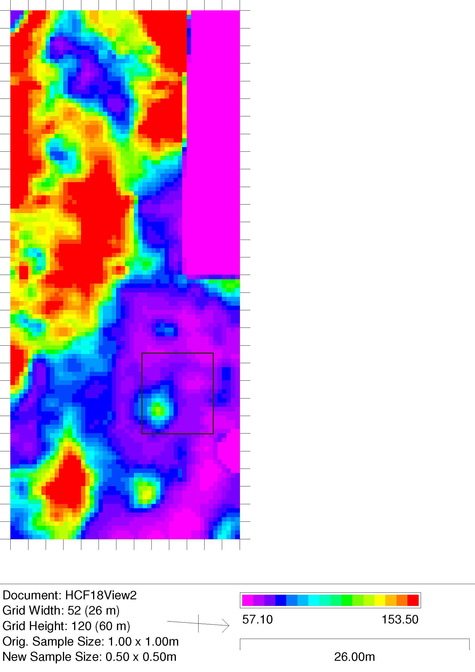
The investigation began in 2018 when the landowner asked if SoTMAS would be interested in investigating the field to try to understand why a chimney had stood on its own for so many years. The field is still called "Chimney Field" by the locals though the chimney, a familiar landmark for the locals of Hilderstone for many years, was dismantled before the year 2000, and it isknown as Old Hall Field on maps. A Resisitivty survey was carried out over the area of the field where the chimney had once stood.
In the survey results the area of interest is in the bottom right hand corner where there are two green anomalies surrounded by a sea of purple. The question was, which of these two anomalies was the remains of the chimney? The upper one was chosen and an area was excavated around it. The excavation has shown that the area of purple in this corner of the survey is actually the area of the field where the building associated with the chimney once stood.
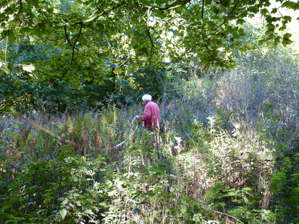
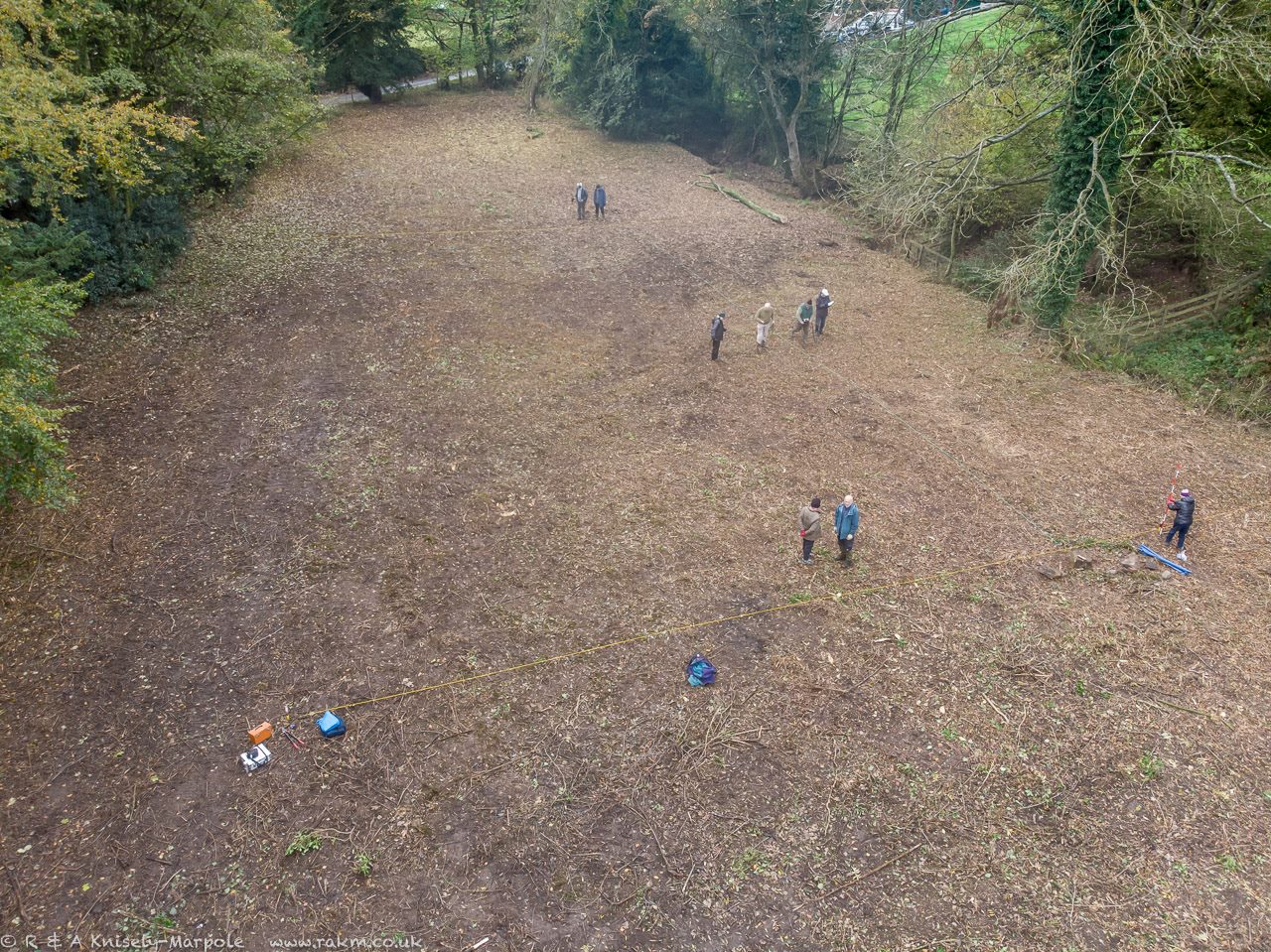
Excavation began in 2019 with Area A being opened to investigate one of the anomalies believed to be the chimney. A second Area, B, was opened in 2021 over the second anomaly, which did uncover the remains of the chimney. Over the following seasons each of these areas were extended as more archaeological evidence and features were uncovered. In 2023 the two separate areas were merged into one single area. What the excavations uncovered is summarised below.
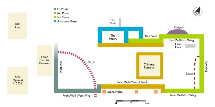
The adjacent plan illustrates the various features that have been uncovered during the excavation. At the begining of 2026 almost all of the footprint of the building has been uncovered. It is clear that the building developed over time, with the building being extended on at least two occasions.
The building reached its full extent around 1680, a period of growing wealth amongst a wider porportion of the population. The site the building is on is not the most suitable. It is evident that the land is very wet and floods regularly, causing problems for the buildings owners. The building was demolished in about 1850 in favour of developing what is now Manor House Farm, visible from the site further along Hall Lane. The then Lord of the Manor, John Bourne, made a number of improvements and changes on the estate during the 1850s and 1860s.
Working from left (West) to right (East) we start with the features outside the West end of the building. This part of the excavation tends to be very wet making digging here difficult, especially as some of the identified features require careful excavation, and this can only be achieved when the area has dried out sufficiently. The area in the bottom left corner has produced evidence of a possible surface or path, and it is hoped this will be further investigated in 2026. In the top right corner it is hoped that it will reveal more evidence for the activity in this area suggested by the resistivity survey.
Just outside the West wall three circular features were identified, their purpose or function has yet to be determined. When they were first discovered in 2021 it was thought they were in a less substantial or temporary extension added to this end of the building. Possibly as a kitchen area. Again it is hoped to investigate these features in 2026.
The West Wing represents the first building on the site. Two corner padstones of a cruck framed building were discovered in 2019. This represents the end wall of the building at the South end of the trench. Work is to continue in 2026 to try and establish where the wall at the opposite end of the building would have been.
Excavation of the floor of the cruck building revealed a curving ditch, possibly a ring ditch, beneath it. Though not shown on the plan, at the end of the 2025 season, a possible cobbled floor of an earlier building was discovered just to the North of the ring ditch adjacent to the West wall. These two features will be further investigated in 2026, along with the NW corner where the resisitivity survey suggests there may be further activity.
The central block or section of the building is the first of at least two extensions added to the building. A row of stone slabs mark the base of the front wall. A wall that would have had a timber frame, with the spaces filled, poossibly with brick, which was plastered and whitewashed. The East end of the extension is where the chimney once stood. From recollections it is known that there were fireplaces on two levels indicating that the building had two floors. In front of the front wall there are several stone holes. It is thought that these may have supported a veranda along this part of the front of the building, and would represent a later addition.
The East Wing is the second extension to the building. The ground floor part of this extension is belived to be a kitchen, a brick lined drain was discovered running from the SE corner out of the building towards the stream behind the building. To accomadate a fireplace in the kitchen the chimney would have required some modification and enlargement. The floor above would probably have been bedrooms.
Though the walls of this extension have been located, their construction is a puzzle. One possibility to be investigated in 2026 is that there had been an earlier building at this point which had been demolished sometime earlier. So when the extension was constructed it reused part of the remains of this building.
One of the most confusing parts of the site is the area in the NE corner, where the back wall of the West Wing is located. Work is continuing to try to understand what was going on with how the walls of this wing were constructed. Under the subsiding back wall of this wing, a midden was discovered (the cause of the subsidence) containing late 16th century pottery, which helps to date the West wing's construction to well into the seventeenth century. A second midden was discovered late in 2025 appox. 1m from the first and extending into the baulk. A full excavation of the midden will take place during 2026.
The area labelled the pantry, is so called as the floor of the room was significantly lower than the ground around it. On the North side of a building, out of direct sunlight, is a good place to construct such a room, though this function may not have been its original use. When discovered this room had been filled in and a tiled floor added, probably as a reaction to the building flooding on several occasions. Emphasised with the addition of a drain in the 1830s to allow flood water to drain away from the building. Removing the fill revealled a stone flagged floor, below which were two further floors. The stone blocks making up the walls appear to have had their joins sealed on the outside with clay in a an attempt to make it water tight, suggesting an earlier use as a possible cistern.
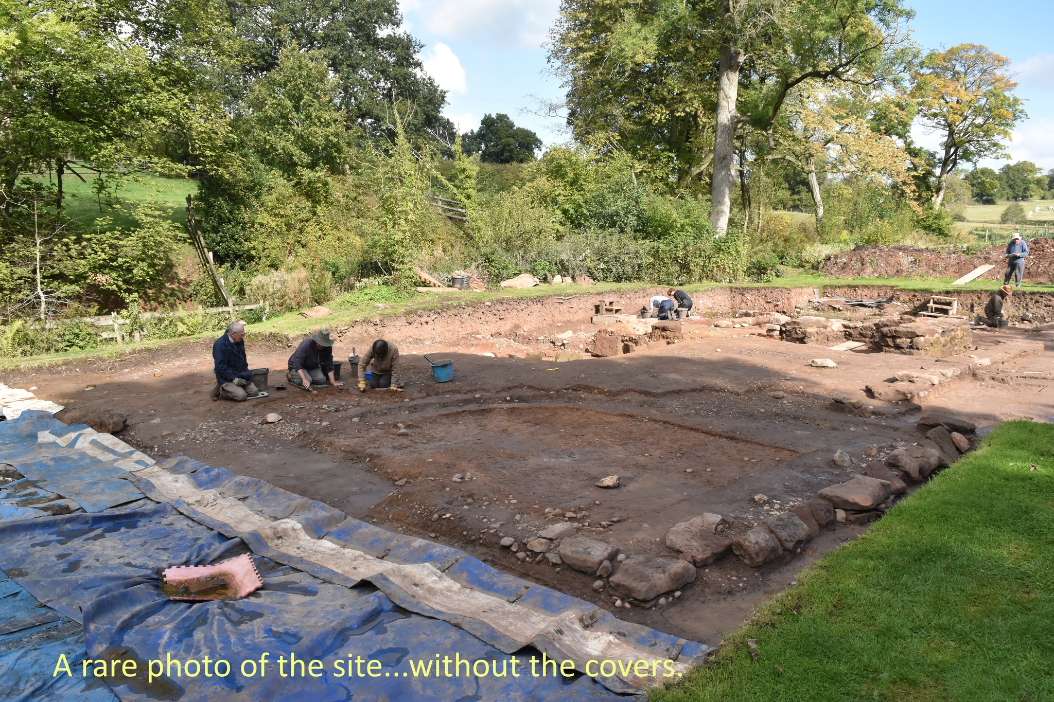
From an empty field, the excavation has developed into a fascinating site, providing an insight into a period of history where propsperity amongst the population began to increase during the seventeenth century. This is seen in the development of this building and the seventeenth century finds that were recovered. Research into the Manor of Hilderstone has shown that individual tenants were farming large parts of the estate. Land that was potentially tenanted by several generations of the same family. This may help to explain the evident increase in wealth of the occupiers of the building during the eighteenth and nineteenth centuries.